Today's ConditionsTemperature: 45 degrees FahrenheitWindchill: 40 degrees Fahrenheit
Dew point: 35 degrees FahrenheitWind: 9mph ECloud cover: OvercastPressure: 1005.2 mb
While it was relatively cold on Saturday, temperatures yesterday rose significantly beyond everyone's expectations. Today a large patch of precipitation is sitting directly over Eau Claire and the Twin Cities area, with plenty more in the Dakotas to come in the near future. An enormous low pressure system is centered over the union of Nebraska, South Dakota and Iowa, causing winds from the entire Midwest to funnel in towards the trough. A stationary front stretches from the Northwest to the Upper Peninsula, effectively slowing down the speed of the passing precipitation systems. With the aforementioned conditions, it is safe to assume that precipitation will continue into tomorrow, with the warm temperatures dropping once the front moves on.
Below is a gif explaining how the Coriolis effect influences wind in a low pressure system. Grab some popcorn, it's a long one.
Today's Haiku
Huge low pressure trough
Causing local winds from East
Going to keep raining
Today's Conditions
Temperature: 34 degrees Fahrenheit
Windchill: 29 degrees Fahrenheit
Dew point: 20 degrees Fahrenheit
Wind: 6mph NW
Cloud cover: Party cloudy
Pressure: 1019.5 mb
I predicted today's conditions with flawless accuracy and I will attempt to do the same for the weekend. Conditions today include gentle winds from the north to northwest with partly cloudy skies and temperatures in the mid 30's. The cold front from yesterday has completely passed us and is a part of a larger stationary front that snakes its way across the entire country. A high pressure dome to our northwest is causing for chilly winds from the north, otherwise temperatures today would have been much nicer. Out west, high pressure systems and scattered precipitation could cause for some light rain or night snowfall along with colder temperatures in the near future.
Today's Haiku
Gentle winds from north
From a high pressure system.
Thank god it's Friday!
Today's ConditionsTemperature: 37 degrees FahrenheitWindchill: 30 degrees Fahrenheit
Dew point: 35 degrees FahrenheitWind: 9mph SCloud cover: FogPressure: 1001.6


Today the clouds have dropped to surface level causing fog and mist throughout the morning, making my prediction of precipitation and warm temperatures correct. There is lots of activity in our region of the country today, such as large amounts of low pressure systems to our southwest with colliding warm and cold fronts. This in combination with a high pressure dome on the east coast is causing consistent winds from the south, bringing up warm air from the maritime tropical air mass. A warm front leading the southern air is just now passing over Eau Claire, raising temperatures to a relatively nice 37 degrees. A long band of precipitation stretching from Lake Superior to Nebraska is headed straight for our area, which should cause the precipitation to increase to rain and continue for the better part of the evening and into tonight. Stuve diagrams display a thermal inversion in our area, causing warmer temperatures and lower cloud elevation due to the higher dew point. Predictions for the future include rain tonight before clearing up tomorrow with partly cloudy skies and similar temperatures.
Today's Haiku
Thermal inversion
Warm temperatures with fog
Be prepared for rain!
Today's ConditionsTemperature: 22 degrees FahrenheitWindchill: 8 degrees Fahrenheit
Dew point: 10 degrees FahrenheitWind: 17mph SCloud cover: OvercastPressure: 1020.8 mb
My prediction from yesterday has yet to come true, as temperatures are still holding in the low 20's. A large high pressure system over St. Louis is sending up winds from the south before they head west for a large low pressure vortex over Montana. There is an extremely large and powerful low pressure system off the coast of Massachusetts which is creating the strongest winds currently on the surface of the Earth. A series of troughs out west are moving their way east towards the Midwest, carrying low pressure and warmer temperatures. Precipitation is also mixed in with the approaching systems, making warmer temperatures and snow/rain a good possibility in the future.
Today's Haiku
Hasn't warmed up yet
Very strong winds on East Coast
Maybe more snow soon
Today's ConditionsTemperature: 17 degrees FahrenheitWindchill: 9 degrees Fahrenheit
Dew point: 2 degrees FahrenheitWind: 5mph NWCloud cover: Partly cloudyPressure: 1023.5 mb
As I predicted yesterday, temperatures were quite similar and the skies were clearer. Constant strong winds from the west caused a very low wind chill which made the weather feel much colder than it actually was. A single high pressure system is dominating most of the midwest today, causing sunny and cold conditions across the heartland. Low pressure systems behind stationary fronts should eventually move our way tomorrow and bring temperatures back up above freezing.
Today's Haiku
High pressure today
Sunny with very cold temps
Should get warmer soon...
Today's Conditions
Temperature: 16 degrees Fahrenheit
Windchill: 14 degrees Fahrenheit
Dew point: 4 degrees Fahrenheit
Wind: 14mph NW
Cloud cover: Overcast
Pressure: 1028.8 mb
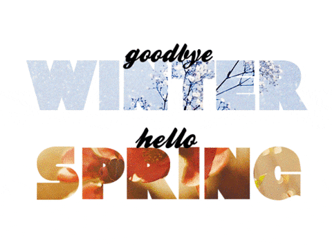
After a much needed vacation, the weather blog has returned just in time for the changing of the seasons. A few days ago the planet experienced the spring equinox, meaning that for about a day's time, the planet's poles weren't tilted and the duration of the daylight was the same at all points on the earth's surface. This means that until the summer solstice, the northern hemisphere will be tilting closer to the sun each day, theoretically raising temperatures from here on out.

Bringing things back a bit more locally, temperatures remain dismal in Wisconsin. A high pressure system to our south along with a low pressure system up north have combined their efforts to give northern Wisconsin a good amount of westerly winds. Precipitation is present in the Twin Cities and should be arriving in no time due to the wind, but it shouldn't last long either. Tomorrow we can expect clearer skies with similar temperatures.
Today's Haiku
Back from vacation
But it's still really cold here
Why did I come back
Temperature: 21 degrees FahrenheitWindchill: 11 degrees Fahrenheit
Dew point: 9 degrees FahrenheitWind: 9mph NCloud cover: OvercastPressure: 1019.8 mb
After a very warm beginning of the week, temperatures have cooled down to the typical winter levels. Much of the snow melt from the last few warm days has completely frozen causing roads and sidewalks to be layered with black ice or very thick ice. A high pressure system north of us is causing moderate winds from the north and northeast, but otherwise weather conditions are very stable and unexciting in northern Wisconsin. On the other hand, a large storm with moderate rainfall is completely covering the northeastern states as it reaches the Atlantic. A warm front to the northwest should hopefully raise temperatures for tomorrow before we receive some more high pressure later on.
Today's Haiku
It got cold again,
Much colder than yesterday.
Not this crap again
Today's ConditionsTemperature: 50 degrees Fahrenheit
Windchill: 47 degrees Fahrenheit
Dew point: 33 degrees Fahrenheit
Wind: 8mph WCloud cover: Scattered CloudsPressure: 1002.7 mb
Today temperatures have reached the warmest of the year! The sky is for the most part clear besides a few stray cirrus clouds in the upper atmosphere. Winds blew gently from the west and created perfect conditions for flying a kite out in the snow. Some precipitation is migrating east from Minnesota, causing for a plausible chance of rain tomorrow. Cloud cover should help trap in some heat tomorrow, but it is safe to say that temperatures will be a little colder than those of today.
Today's Haiku
Fifty degrees, yay!
Everything melted and made
An enormous mess
Today's ConditionsTemperature: 31 degrees Fahrenheit
Dew point: 24 degrees FahrenheitWind: 5mph S
Cloud cover: OvercastPressure: 1010.6 mb
As of 10:30 AM, no snowfall has been recorded. Weather forecasts claim that there is still a 40% chance of snowfall by the end of the day. The sky is blanketed by a layer of stratus clouds moving slowly from the south which typically yields heavy rainfall in the near future. Temperatures are still barely freezing which will cause any precipitation to fall as snow or sleet. The surface map displays a cold front directly on top of Eau Claire carrying low pressure, which would cause a change in wind direction from the south to the northwest. Temperatures are expected to drop with a chance of precipitation.
Today's Haiku
It may snow today
But it also may not snow
Look at that cold front
Today's ConditionsTemperature: 23 degrees Fahrenheit
Dew point: 14 degrees Fahrenheit
Wind: 14mph SCloud cover: OvercastPressure: 1023.2 mb
Since the cloud cover moved in over Eau Claire today, temperatures rose in comparison to yesterday as predicted by yesterday's blog entry. Winds are moderately paced and traveling from from the south, which means there must be a high pressure system to our east causing the winds to spiral out in a clockwise direction and reach us. Stratus cloud cover moving from the south tells us that precipitation is likely in the near future, and observing the surface map helps confirm that prediction. There is a large warm front carrying low pressure heading directly for the midwest with plenty of scattered showers behind it.
Today's Haiku
High pressure system
Causing winds to blow from south
Snowfall is likely
Today's Conditions
Temperature: 19 degrees Fahrenheit
Dew point: 6 degrees Fahrenheit
Wind: 13mph NE
Cloud cover: Scattered clouds
Pressure: 1033.2 mb
While it didn't snow as I predicted, it did warm up considerably today. The skies are clear and the sun is heating up the surface to near 20 degrees Fahrenheit. Upper air soundings are reporting extremely stable conditions, and a stationary front is present out west and wrapping across Missouri. There is no precipitation headed towards Eau Claire for the near future, besides some systems over the Pacific Northwest. Tomorrow we can expect similar conditions with a possibility of some cloud cover from the stationary front out west, which will result in warmer temperatures.
Today's Haiku
Warm and sunny day
Expect the same tomorrow
But with clouds instead
Today's ConditionsTemperature: 11 degrees Fahrenheit
Dew point: 5 degrees Fahrenheit
Wind: NoneCloud cover: Overcast Pressure: 1024.5 mb
My prediction held true, it was a cold weekend with a decent amount of snowfall coming from the Northwest. It snowed briefly this morning due to some leftover precipitation from the large storm that is now over Michigan. A large warm front carrying low pressure is approaching from the West, which is causing a precipitation system to move our way beforehand. This system could possibly push north and avoid the Eau Claire area, but with our luck we should expect some more precipitation tonight. A high SI value from the upper air soundings tells us that we shouldn't expect any severe weather anytime soon. Taking a look at the rest of the country, the South is continuously being bombarded with freezing rain, causing massive transportation problems and power outages.
I'm not particularly happy about it, but Eau Claire has just broken the previous record for the coldest winter in history. This means that the average temperature is lower than ever recorded in Eau Claire, Wisconsin. Hopefully it won't last all year.
Today's Haiku
Congratulations
Coldest winter ever in
Eau Claire, Wisconsin