Today's Conditions
Temperature: 60 degrees Fahrenheit
Dew point: 51 degrees Fahrenheit
Wind: 5 mph E
Cloud cover: Fair
Pressure: 1008.1 mb
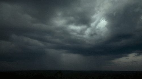
My prediction of rain has yet to become true, although the air has been quite humid and skies in the distance are growing darker with each hour. Low pressure located to our west is pulling warm, moist air from the gulf up to northern Wisconsin and then back west to the low pressure center, causing gentle, warm eastern winds in Eau Claire. An enormous warm front is heading north to Wisconsin which should cause for a significant rise in temperatures later on today, and quite possibly causing the warmest temperatures of the year so far. A large patch of thunderstorms is caught between western high pressure and eastern low pressure, which will cause these storms to hit the Twin Cites before too long. Large quantities of sharks in the gulf have been picked up by these strong winds and are traveling at alarming speeds towards the storm system.
Today's Haiku
Sharks are heading North
They were picked up by the wind
It's a sharknado
Today's ConditionsTemperature: 65 degrees Fahrenheit
Dew point: 48 degrees FahrenheitWind: 13 mph SECloud cover: A few cloudsPressure: 1007.7 mb
After some morning thunderstorms, the clouds have gone away and left behind a perfectly sunny day. Warm air is being pulled from the gulf and brought directly up to the Midwest, at least for the beginning of the day. Through the afternoon the clouds have started to roll back in, and SE winds tell me that some serious low pressure is located to our southwest. This pressure could develop into some serious storms considering the moisture that is being dragged from the coasts into the Midwest. I predict more thunderstorms tonight and into tomorrow, with rain continuing for most of the day.
Today's Haiku
Wind from the southeast
Neither fit for man nor beast
A storm's a comin'
Today's ConditionsTemperature: 54 degrees Fahrenheit
Dew point: 32 degrees FahrenheitWind: 12mph ECloud cover: OvercastPressure: 1017.4 mb
After almost an entire week of precipitation, the clouds have broken down and allowed for some sunshine and warmer temperatures over the weekend. The sky remains mostly cloudy for the time being with temperatures reaching a high of 60 degrees Fahrenheit. High pressure from the north is causing winds to spiral out in a clockwise pattern, striking up from the eastern side. Many low pressure patterns out west have created a large trough with intersecting stationary and cold fronts, causing scattered showers and patches of cold temperatures.
Today's Haiku
Cloud cover is high
But it is still very nice
Tomorrow, the same
Today's ConditionsTemperature: 44 degrees Fahrenheit
Dew point: 41 degrees FahrenheitWind: 8mph NCloud cover: OvercastPressure: 1005.3 mb
The low pressure system from yesterday has migrated northward to the upper peninsula, causing the precipitation to remain over northern Wisconsin. This change in pressure has also shifted the winds to the north instead of the easterly direction from earlier this week. All levels for today are similar to the week's trend, only varying by a few units for all measurements. As the low pressure shifts eastward we should expect winds to change to the west following the pressure gradient, allowing the precipitation to finally clear out and cause some clear skies for the weekend.
Today's Haiku
I'm getting tired of
all of the April showers.
Time for May flowers
Today's ConditionsTemperature: 42 degrees Fahrenheit
Dew point: 38 degrees FahrenheitWind: 6mph NCloud cover: OvercastPressure: 1005.8 mb
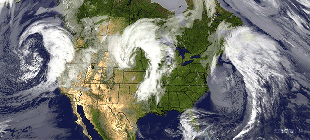
Scattered precipitation, cold temperatures, and north/northwest winds compose today's conditions. With the low pressure migrating towards Wisconsin, it wasn't too difficult to predict that the winds would start to shift to a northern origin. By the time of this prediction the low pressure zone has moved directly over central Wisconsin, causing gentle north winds from across Lake Superior. The radar still shows a number of precipitation bands moving in from the west, which makes afternoon or evening rain a strong possibility. Taking a look at other regions, the west coast is entirely dry, while the east coast is being pummeled by the left overs of the midlatitude cyclone earlier this week. New England is almost completely blanketed with precipitation and a dry line is moving storms over Florida.
Today's Haiku
Rain finally stopped,
But it should restart later
What a gloomy week
Today's Conditions
Temperature: 40 degrees Fahrenheit
Dew point: 37 degrees Fahrenheit
Wind: 10mph NE
Cloud cover: Overcast and raining
Pressure: 1003.0 mb
As I predicted, the rain has continued through the night and has yet to stop today. Temperatures and pressure levels have hardly changed since yesterday's update, and once again the conditions are likely to carry over into tomorrow with the chance of snow if the temperatures allow it. The low pressure system controlling the cyclone has shifted to the southeast of its original position, which has caused local winds to shift more towards the north than yesterday's strong east winds. The strong mid-latitude cyclone from yesterday has lost some of its strength, as the precipitation bands have begun to migrate away from the low pressure center. My prediction for tomorrow includes precipitation, colder temperatures, and winds shifting towards the northwest.
Today's Haiku
It's still raining here
Good thing it's not snowing yet
Hopefully it won't
Today's ConditionsTemperature: 45 degrees Fahrenheit
Dew point: 36 degrees FahrenheitWind: 26mph ECloud cover: Overcast and rainingPressure: 1006.0 mb
Rain, rain, and more rain. Strong winds from the east are telltale signs of low pressure to the
southwest and inclement weather. "When the wind is in the east, 'Tis neither good for man nor beast." The low pressure system causing this mess is centered over Nebraska and is orchestrating the wind patterns for the entire country, pulling winds up from the gulf, down from Canada, and across the Great Lakes, along with drawing in from the high pressure systems on the east and west coasts. A large band of precipitation is currently covering Wisconsin, Minnesota and much of the Dakotas. Strong east winds will try their best to keep this storm stationary, and I predict it will definitely stick around for the next few days.
Today's Haiku
Rain, rain, go away
Come again some other day
I'm serious though