Temperature: 42 degrees Fahrenheit
Dew point: 38 degrees Fahrenheit
Wind: 6mph N
Cloud cover: Overcast
Pressure: 1005.8 mb

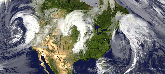
Scattered precipitation, cold temperatures, and north/northwest winds compose today's conditions. With the low pressure migrating towards Wisconsin, it wasn't too difficult to predict that the winds would start to shift to a northern origin. By the time of this prediction the low pressure zone has moved directly over central Wisconsin, causing gentle north winds from across Lake Superior. The radar still shows a number of precipitation bands moving in from the west, which makes afternoon or evening rain a strong possibility. Taking a look at other regions, the west coast is entirely dry, while the east coast is being pummeled by the left overs of the midlatitude cyclone earlier this week. New England is almost completely blanketed with precipitation and a dry line is moving storms over Florida.
Today's Haiku
Rain finally stopped,
But it should restart later
What a gloomy week
No comments:
Post a Comment